Melbourne to Perth Roadtrip

January 2021

Start of a new year and start of a new chapter. Having recently accepted a new position over in Perth, I packed up all my things from Melbourne and made the looooonng trip from Melbourne to Perth. How long you say, well, 3,500 kms!

The following is a day by day account of the trip, with photos taken from a bunch of scenic places on the trip.

Day 1 - 18th January 2021 - Melbourne to Adelaide (~750kms)

Unfortunately no photos from this section of the drive given that I’ve done it before, and primarily just wanted to get out of Victoria so that the clock could start ticking on the amount of days that I’d spent outside of Victoria (which had been re-classed as a ‘Low Risk’ zone by Western Australia that very morning.

Day 2 - 19th January 2021 - Adelaide to Kimba (~500kms)

A more relaxed drive today involved travelling from just outside the city centre of Adelaide to the country town of Kimba. During the drive I made a number of stops at various locations including the following:

  • Lake Bumbunga - An expansive salt lake right next to the Princes Highway in the town of Lochiel

  • Mt Remarkable National Park - A beautiful national park marking the southern point of the Flinders Ranges in semi-arid surroundings. Definitely a place that I’d like to explore further in the future.

  • Port Augusta - The main town on the drive through, Port Augusta is the crossroads for those heading west to the Eyre Peninsula and Western Australia and those heading north to central Australia

  • Kimba - One of many small country towns between Port Augusta and Ceduna, Kimba is almost smack bang in the middle between the east and west coasts as represented by an enormous sign at the entrance of town, showing it as ‘Halfway Across Australia’

  • Lake Gilles - Choosing to spend the night at a free campground in the middle of town, I decided to spend golden hour exploring the nearby salt lake of Lake Gilles until the sun went down.

Day 3 - 20th January 2021 - Kimba to Point Sinclair (~400km)

Today marked a new milestone for me in terms of how far west I have been within the country (with more to come!). Previously, back in 2018 when I had completed a trip throughout South Australia over the Summer holidays, I had driven as far as Smoky Bay (just south of Ceduna) prior to heading back to Adelaide. During the drive I stopped over at a few places include:

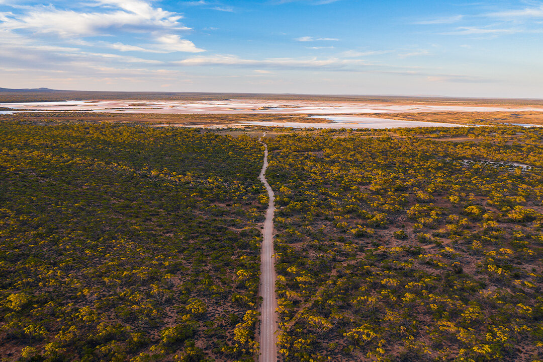
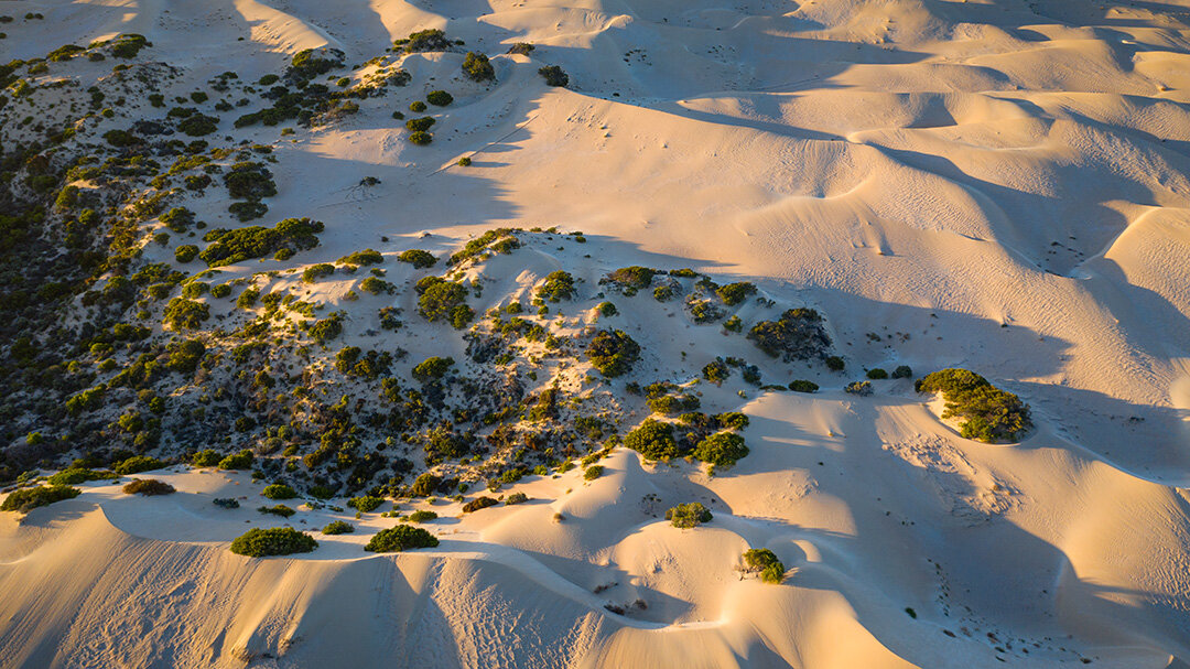
Wudinna - One of many small country towns dotted along the Eyre Highway, I stopped by here after finding that it had a number of salt lakes to the south of the town whilst browsing Google Maps the night before which I explored using my DJI Mavic Pro 2

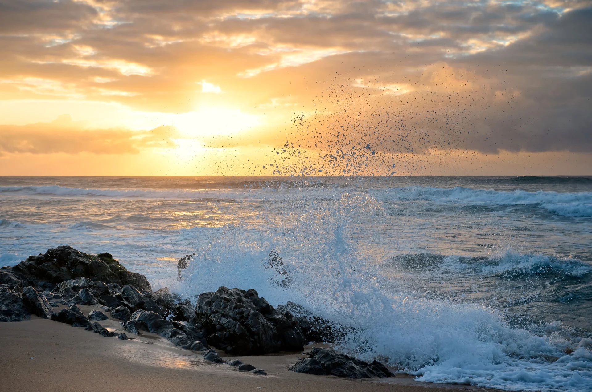
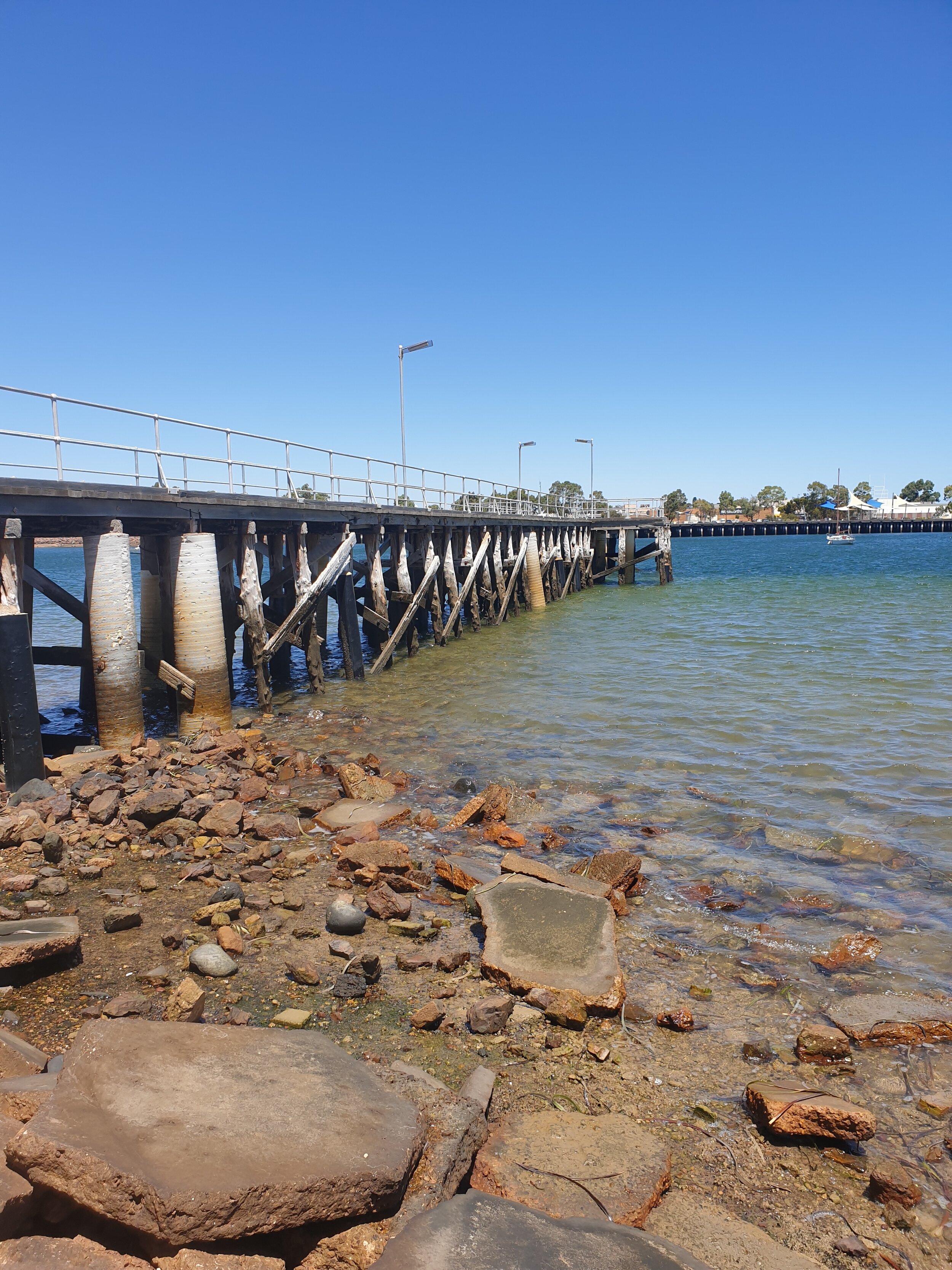
Ceduna - The last main town before the start of the road leading into the Nullabor, Ceduna is beautiful seaside town with a busy port acing as a hub for the extraction and delivery of gypsum and mineral sands.

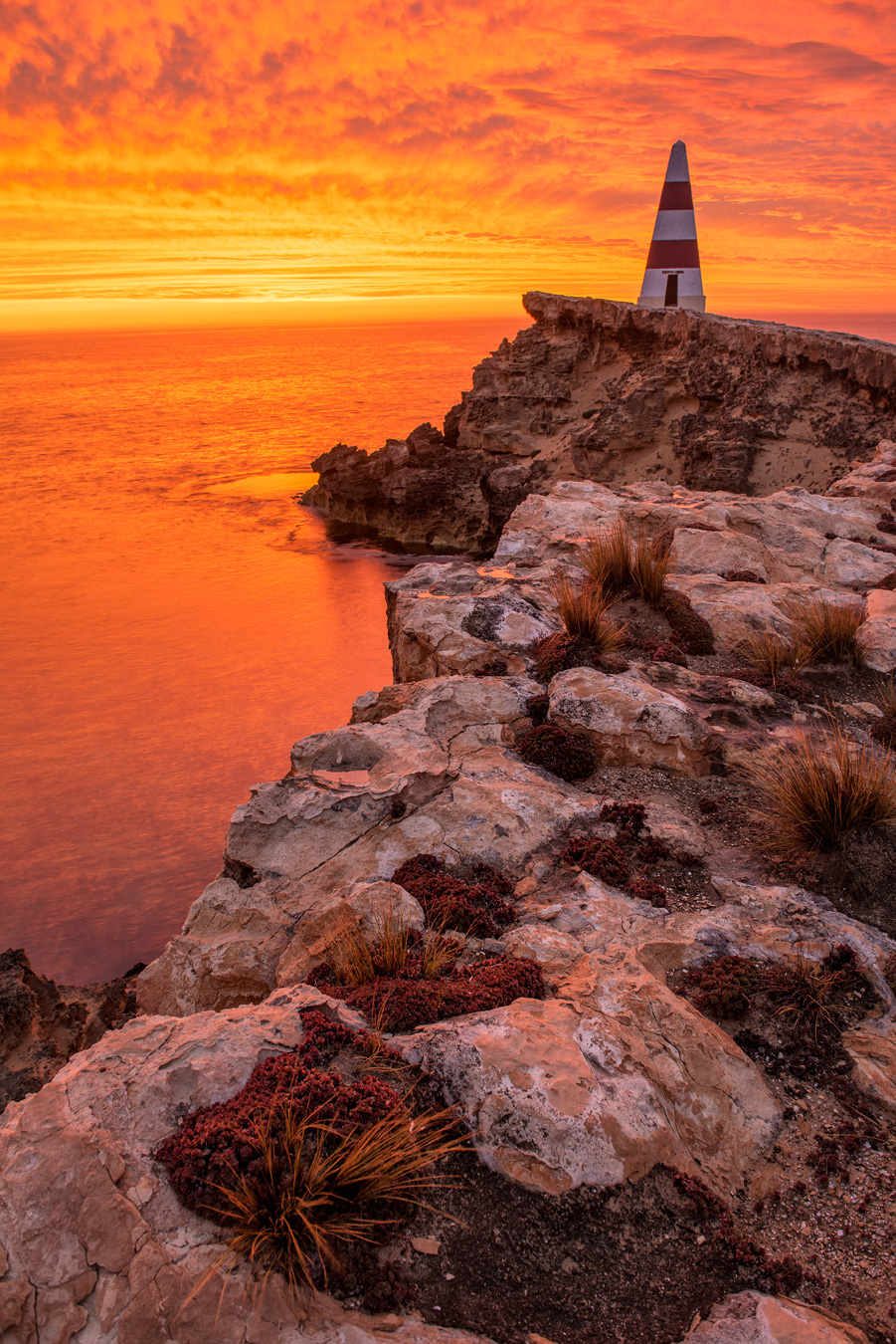
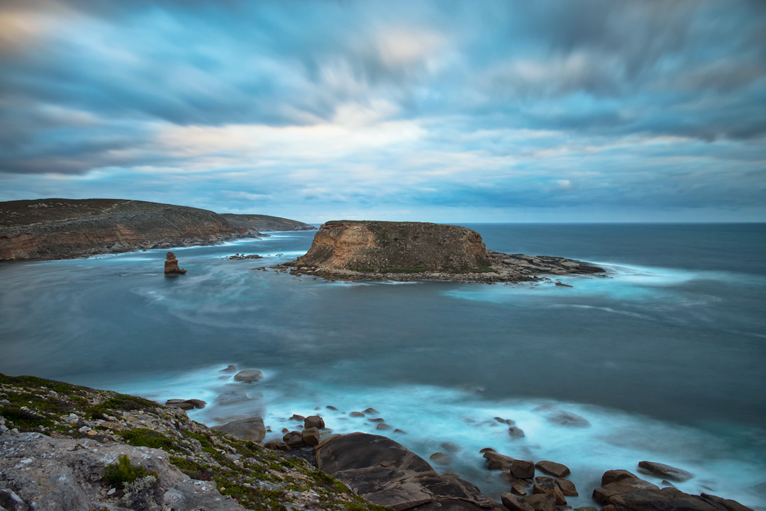
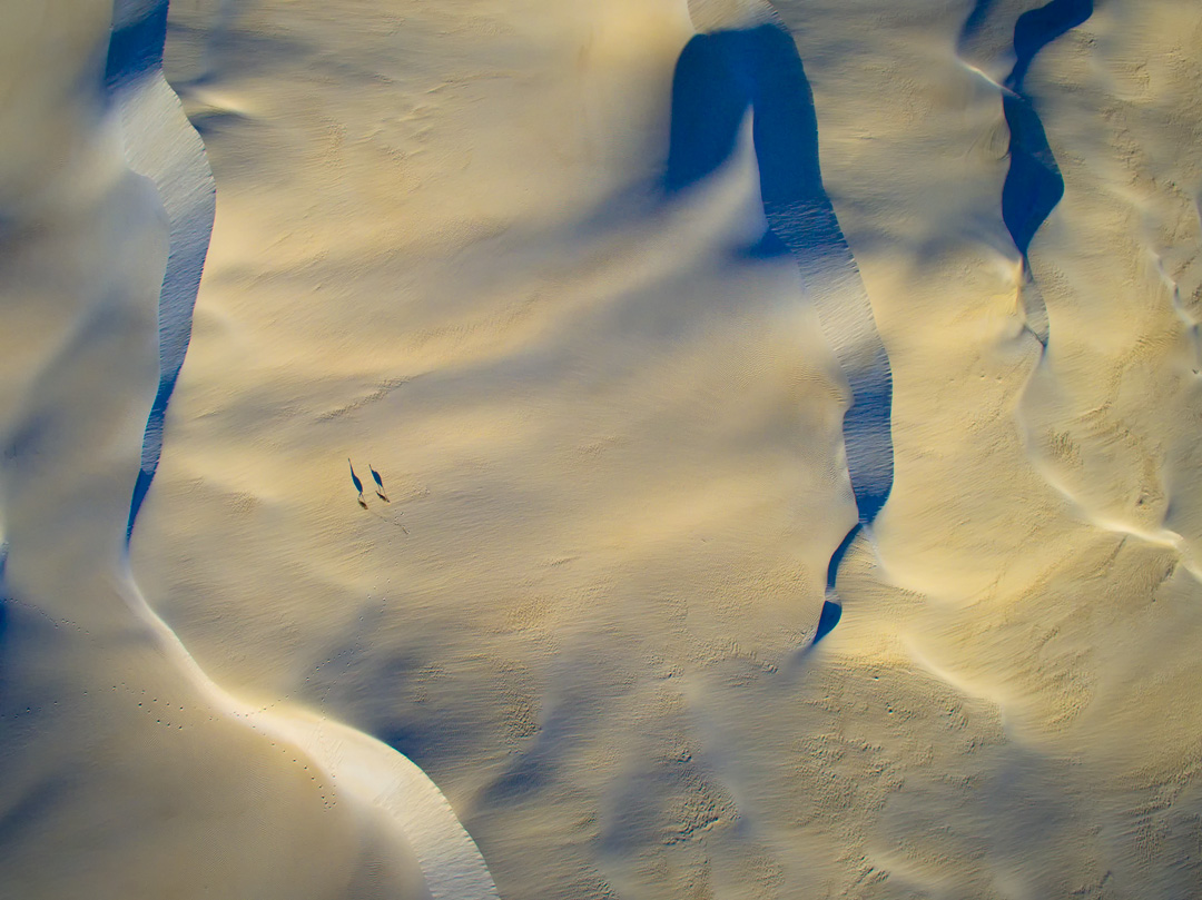
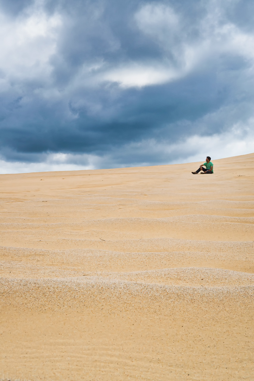
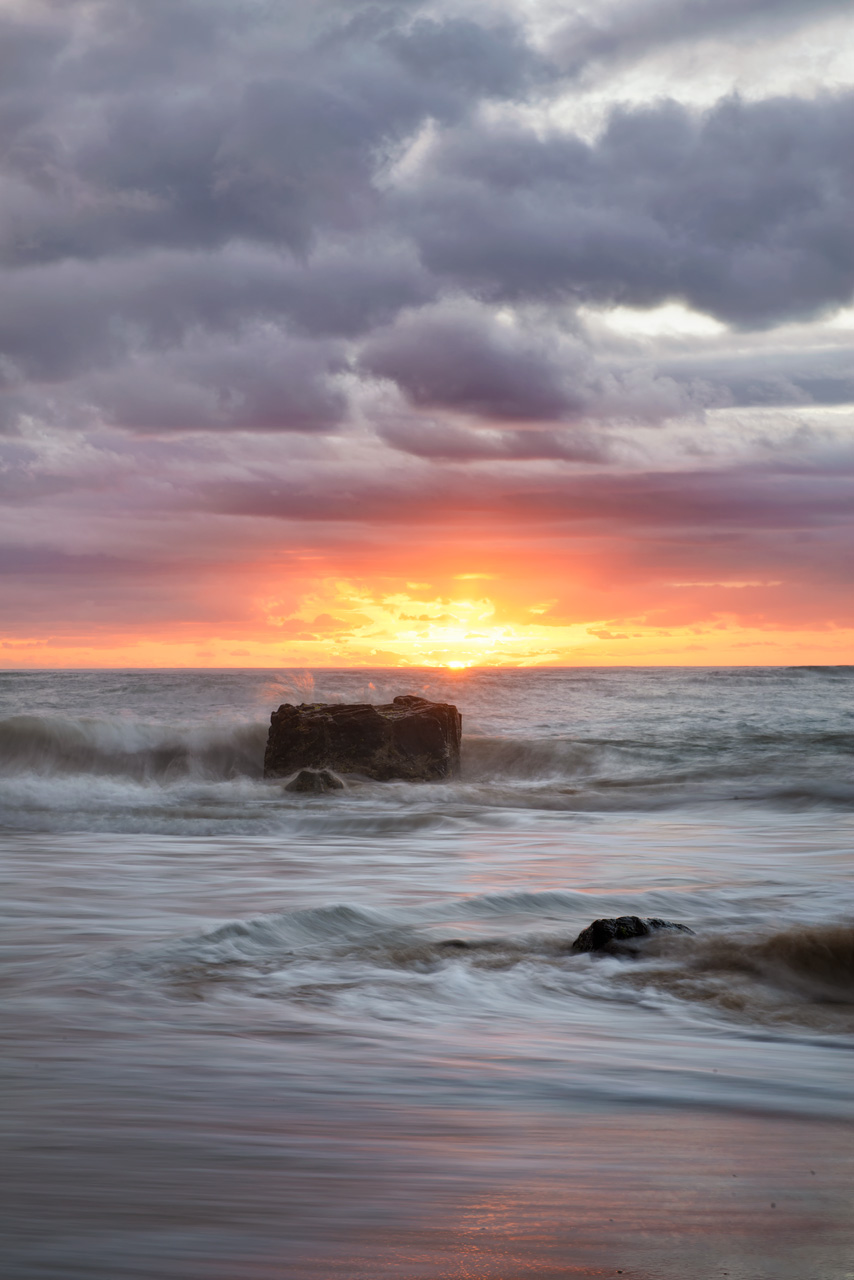
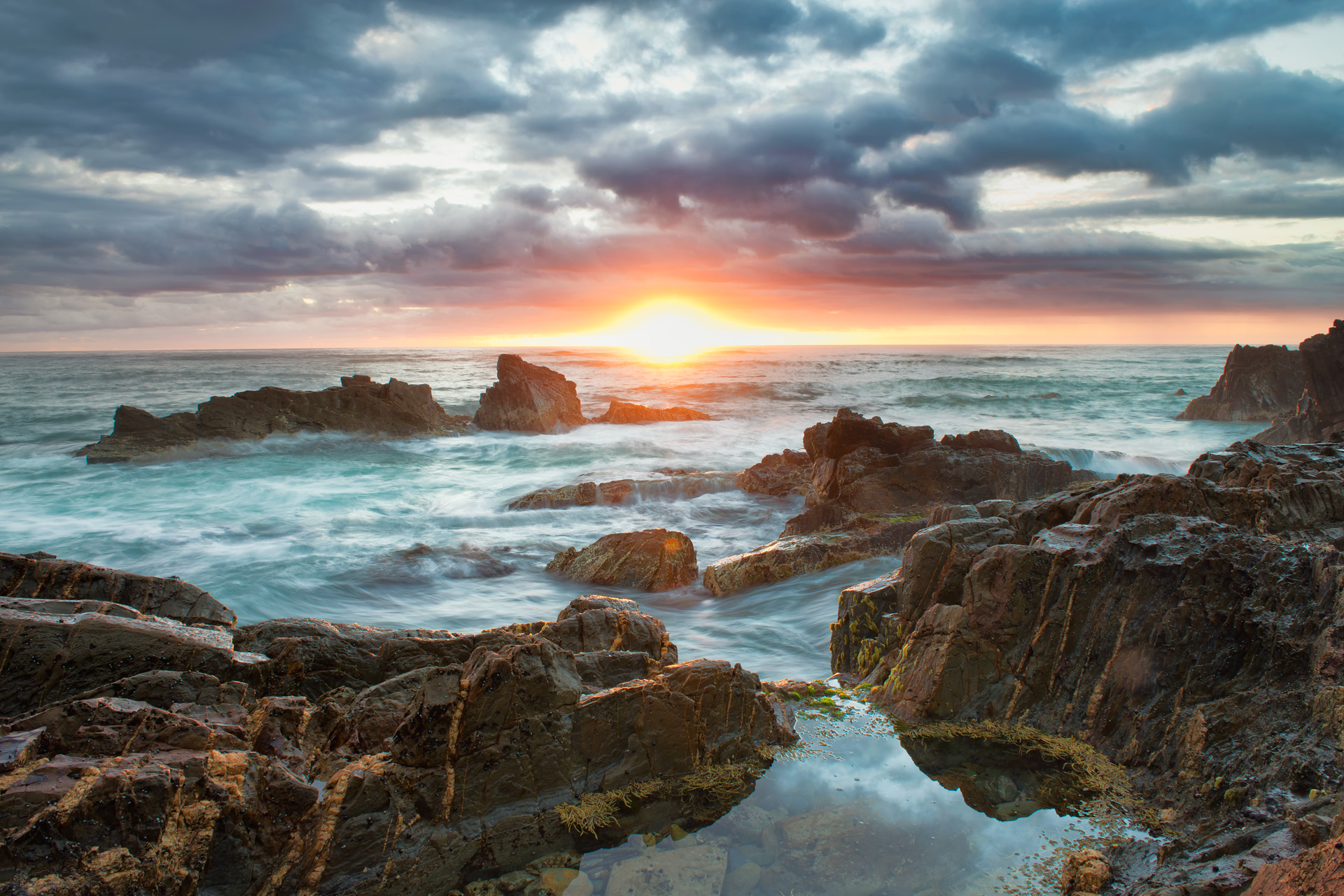
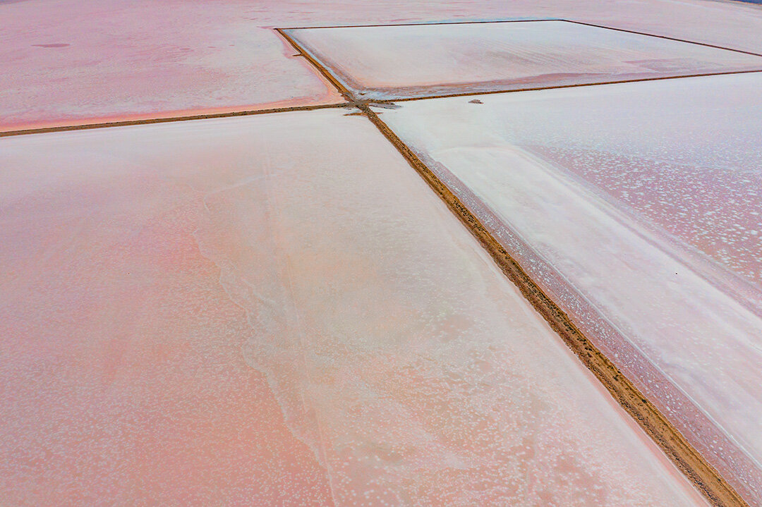
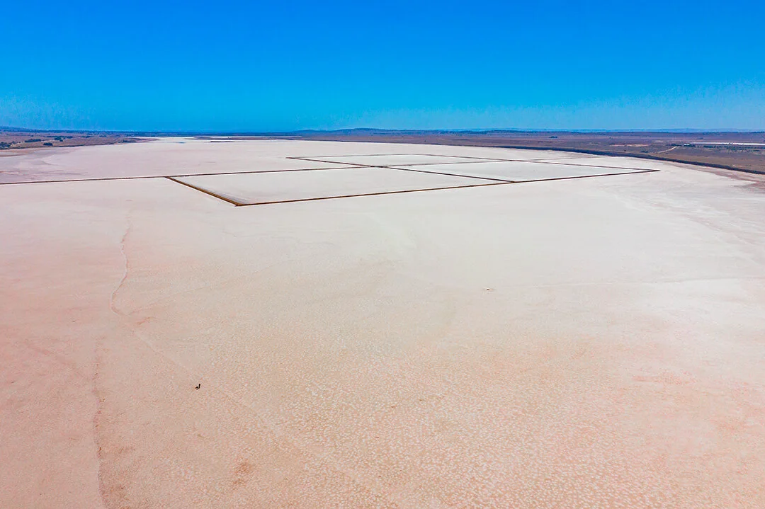
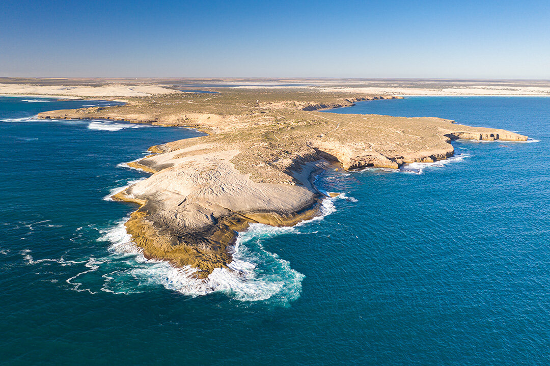
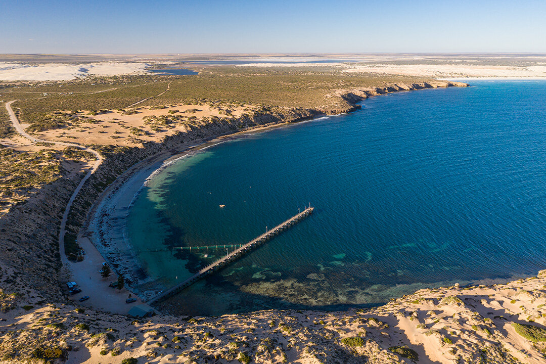
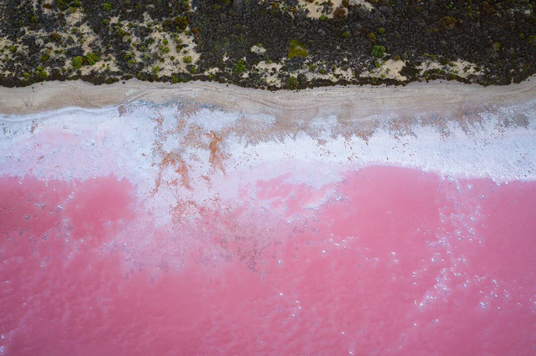
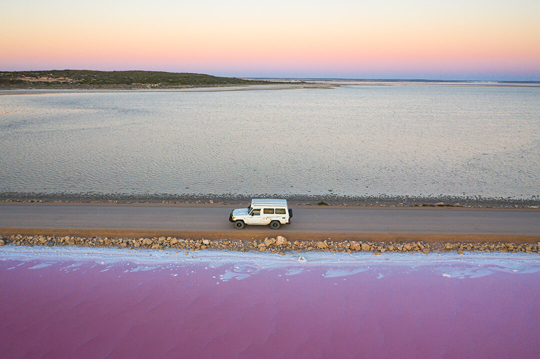
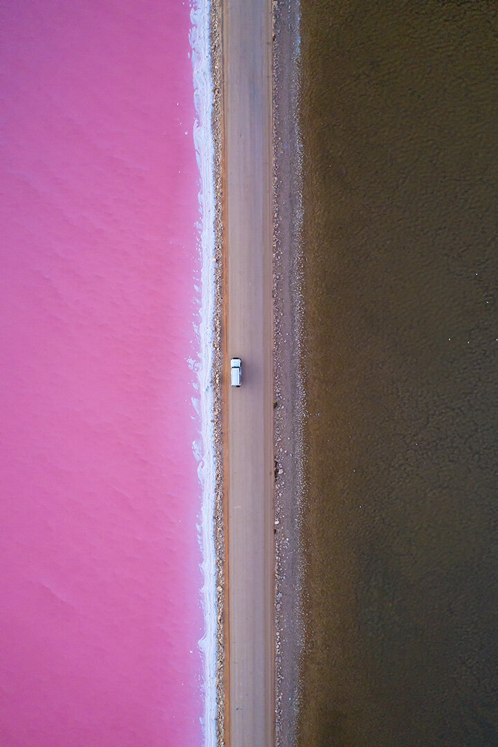
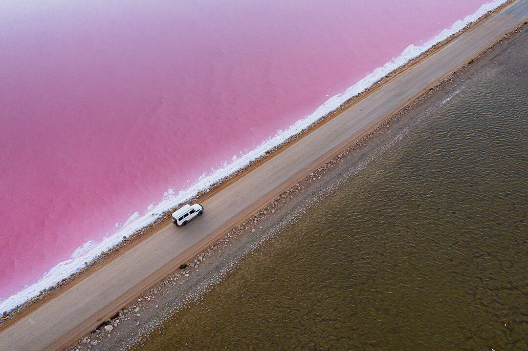
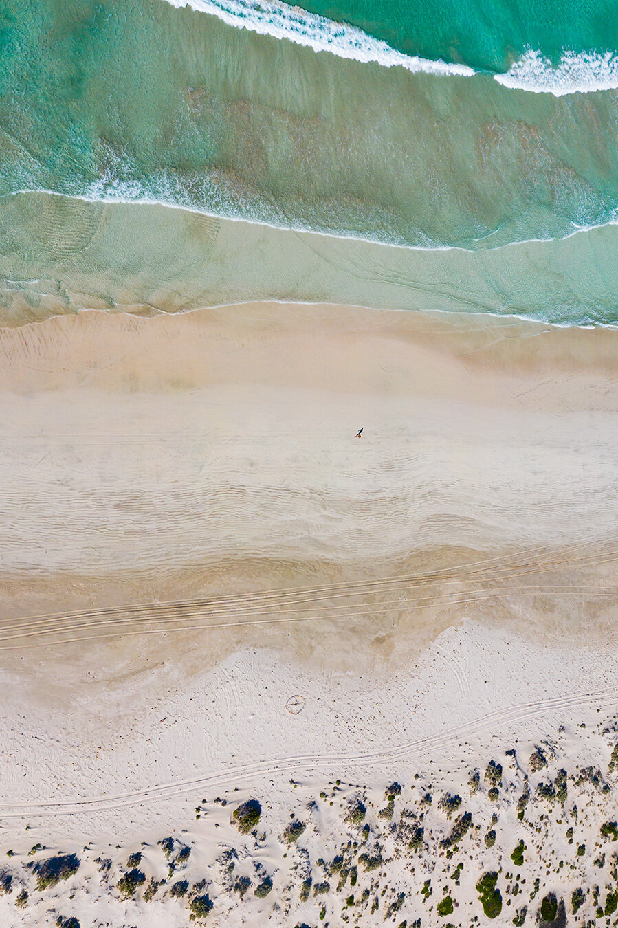
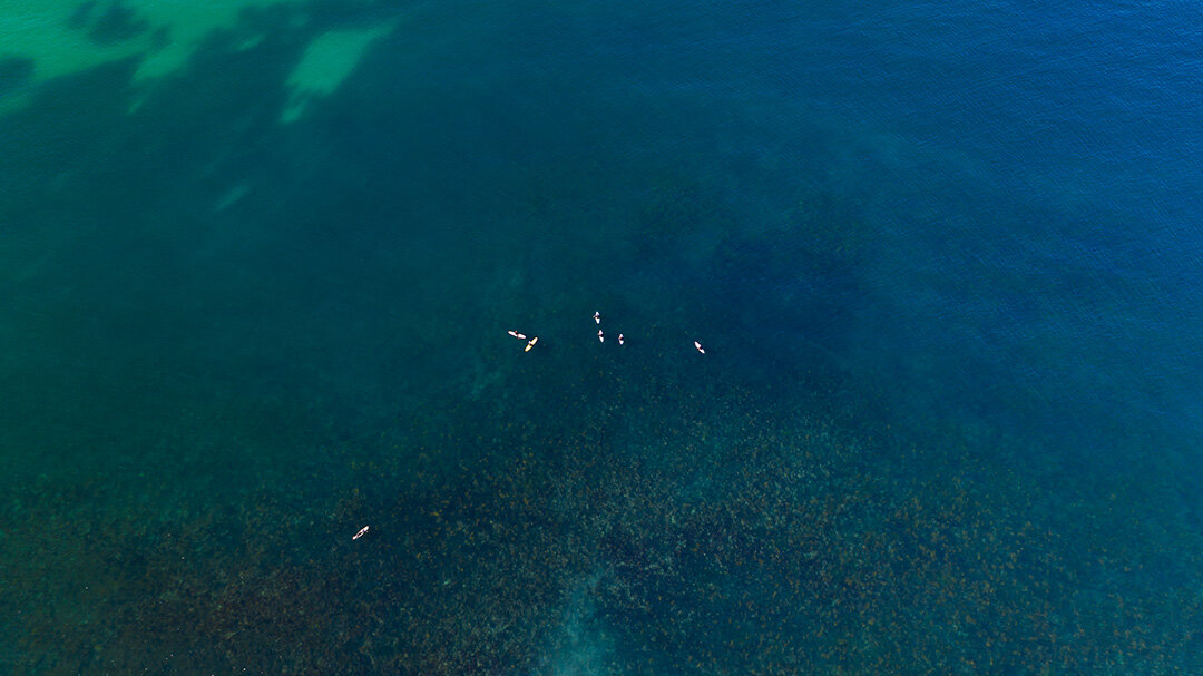
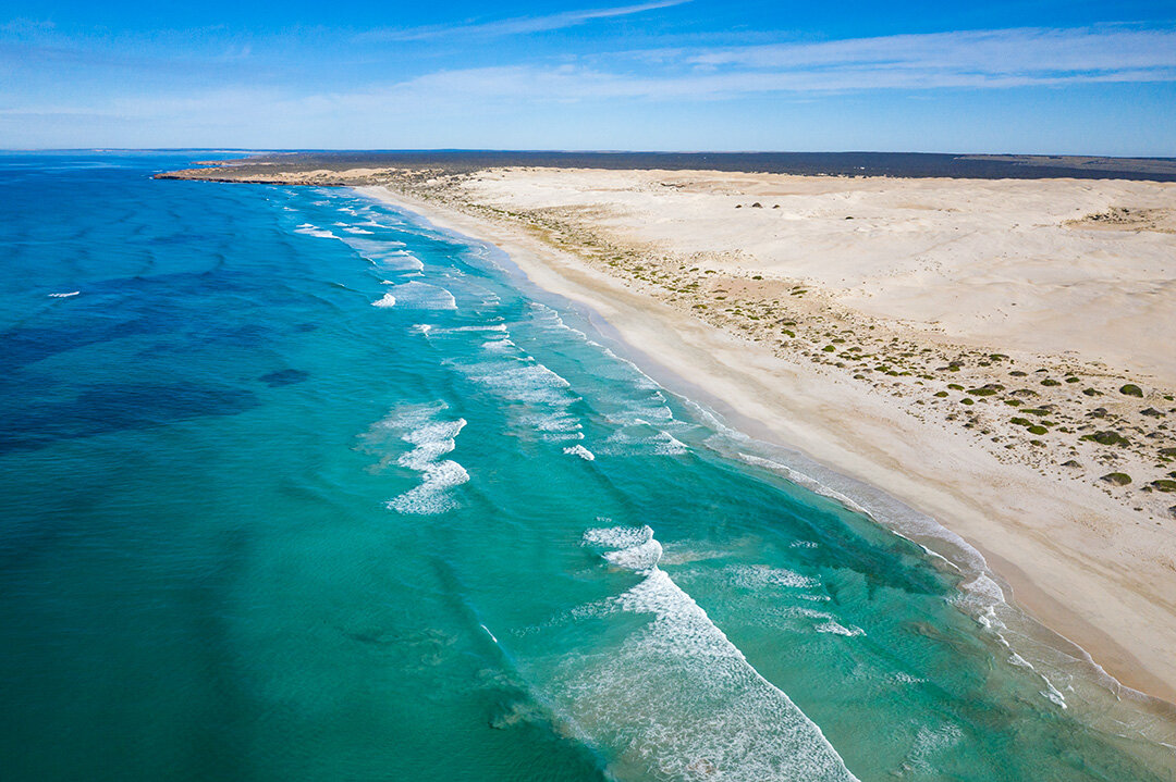
Point Sinclair - Known primarily for the western section of coastline known as Cactus Beach, this area produces some of the best surf breaks in Australia, and it was definitely popular! In addition to the surf, the road to Point Sinclair also passes through Lake MacDonnell, a salt lake with an almost over-worldly pinkish hue to it which makes for some amazing photographs. I spent the night at the Point Sinclair Campground before heading further west the next day.

Day 4 - 21st January 2021 - Point Sinclair to the Nullabor (400kms)

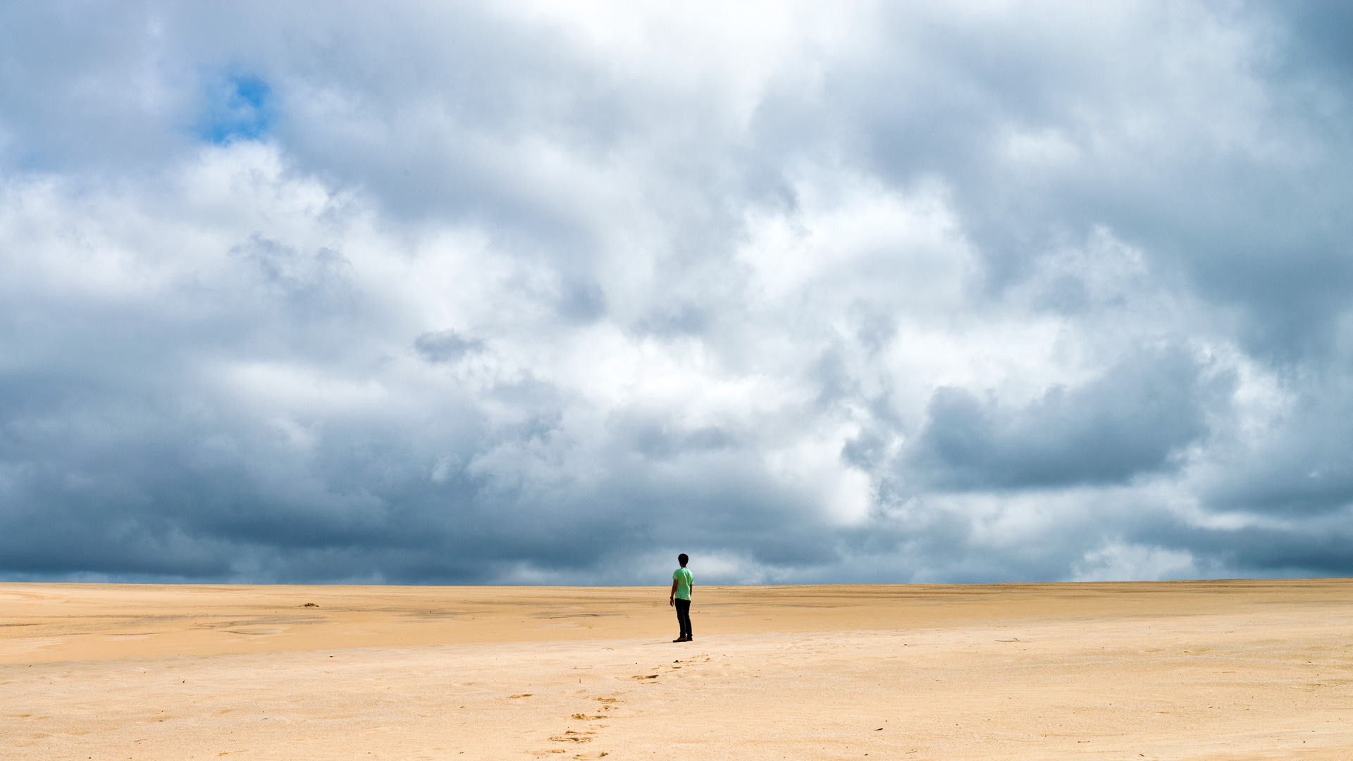
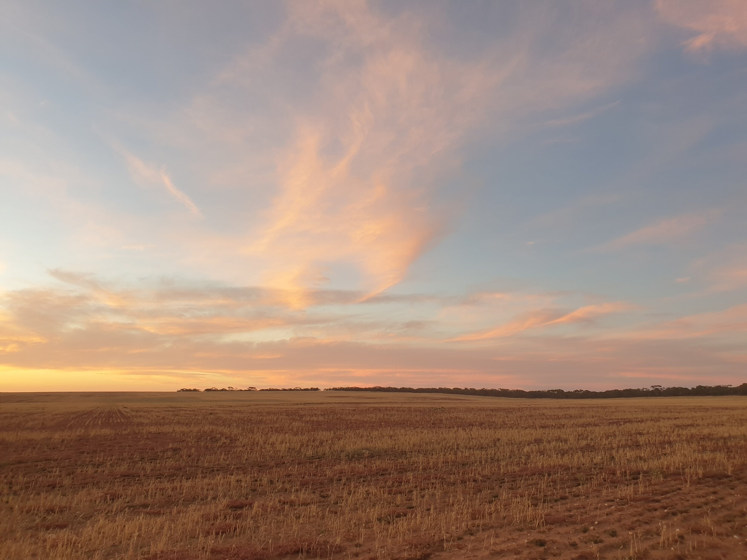
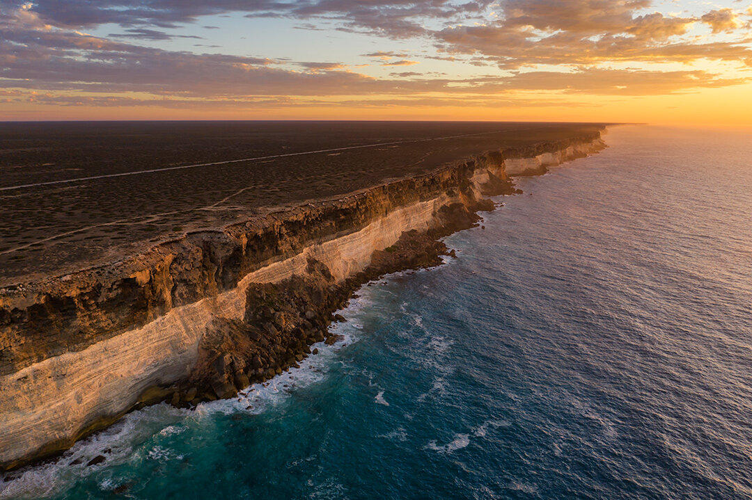
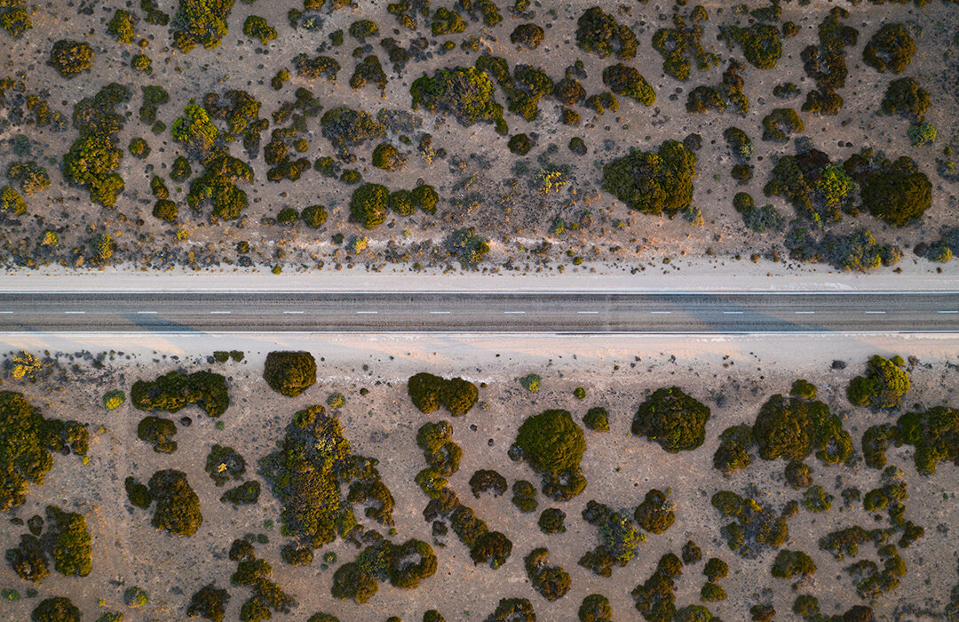
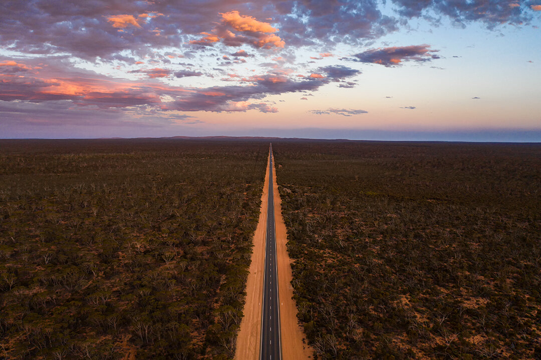
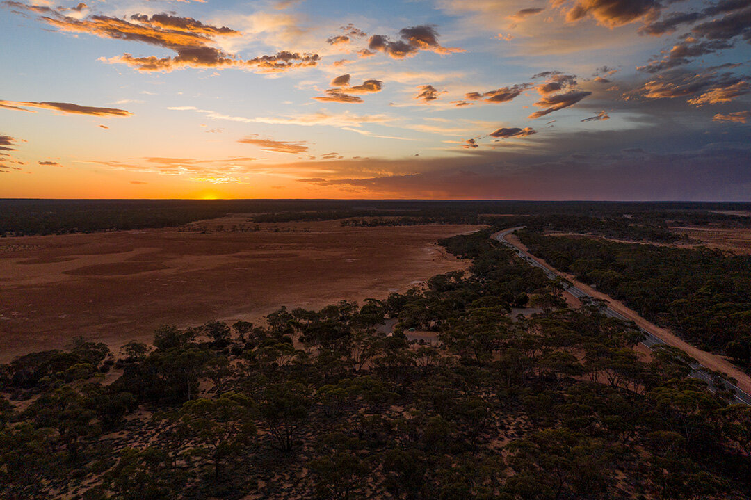
Today marked my foray into the start of the Nullabor. For those of you who aren’t from Australia, the Nullabor Plains are an enormous expanse of arid country comprising the southern coastline between South and West Australia. It’s the world’s largest single exposure of limestone bedrock and comprises an area of almost 200,000 square km. Which takes a fairly long time to pass. There are a number of road houses along the way, but with those as the exception, the landscape is most flat and barren.

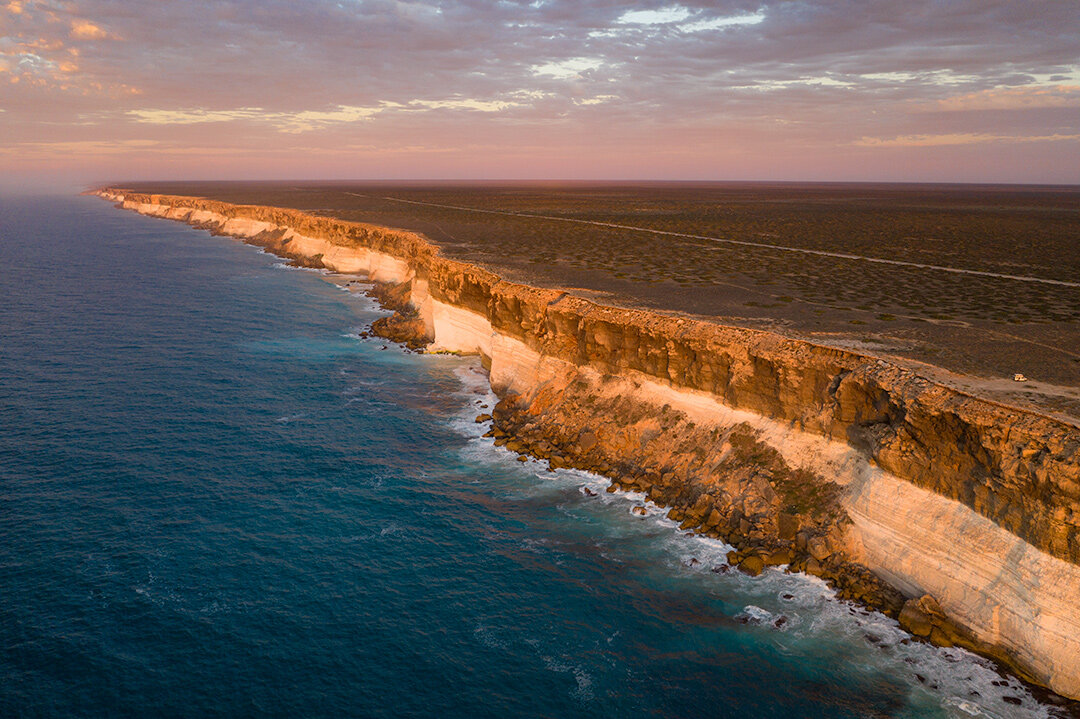
I ended up camping right near the edge of the Bunda Cliffs, approximately 40km from the WA border.

Day 5 - 22nd January 2021 - The Nullabor (650kms)

Today marked my foray into Western Australia. Unfortunately due to COVID-19 restrictions, I was subject to a quarantine order and as such, was required to make the trip from the SA/WA border to Perth within 48 hours.

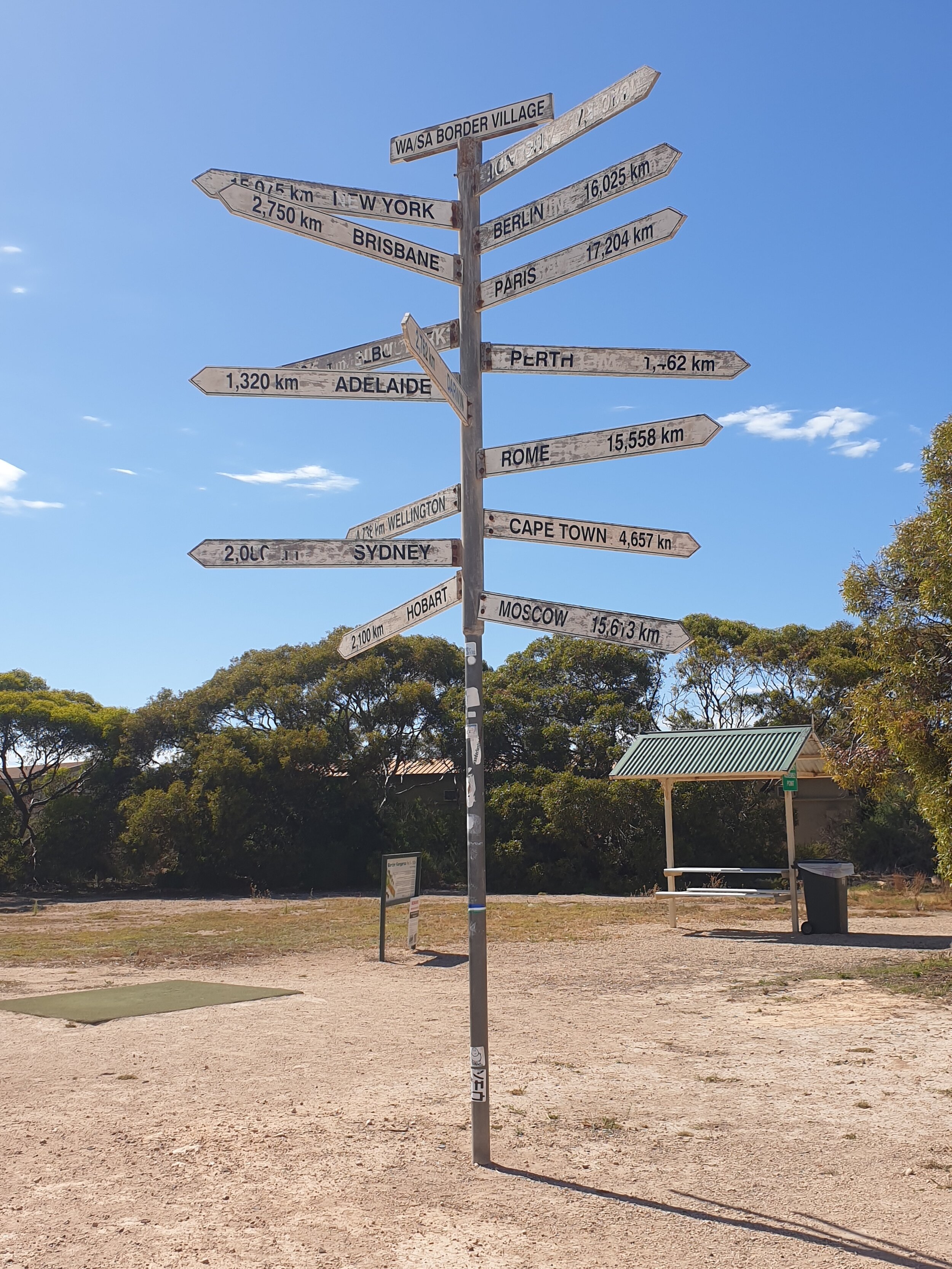
Day 6 - 23rd January 2021 - The Nullabor to Perth (700kms)

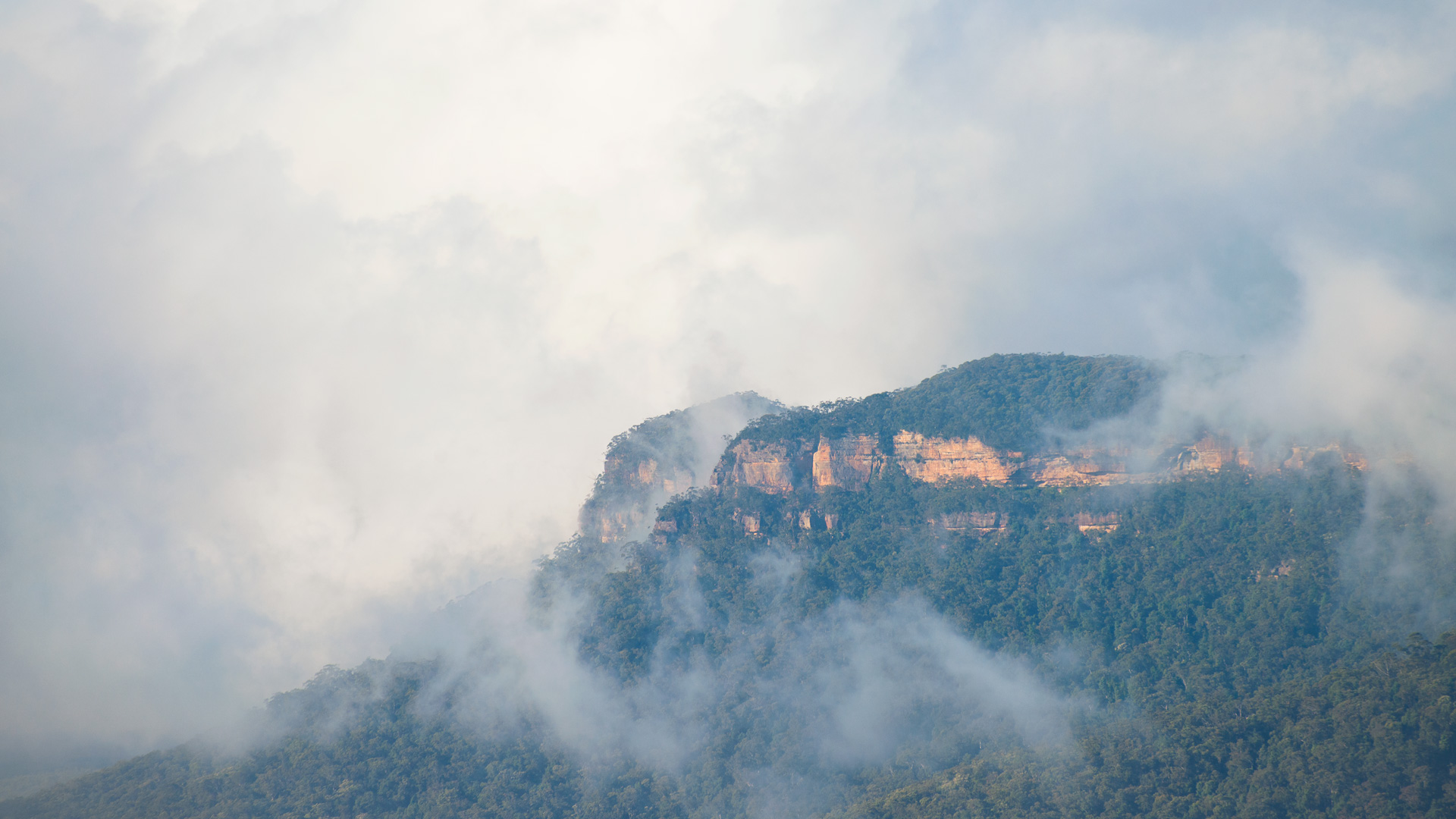
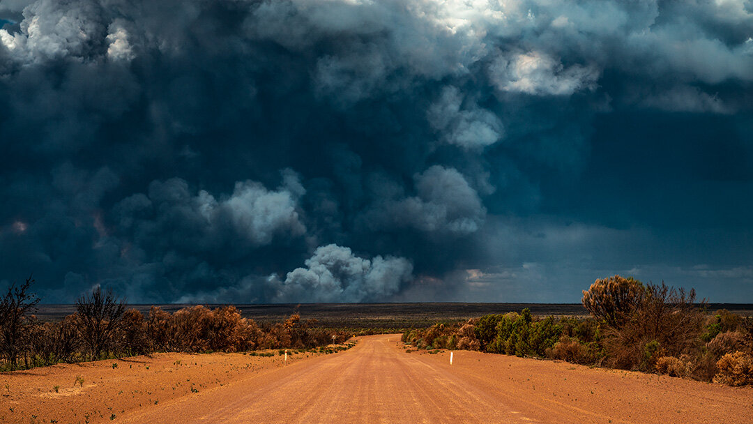
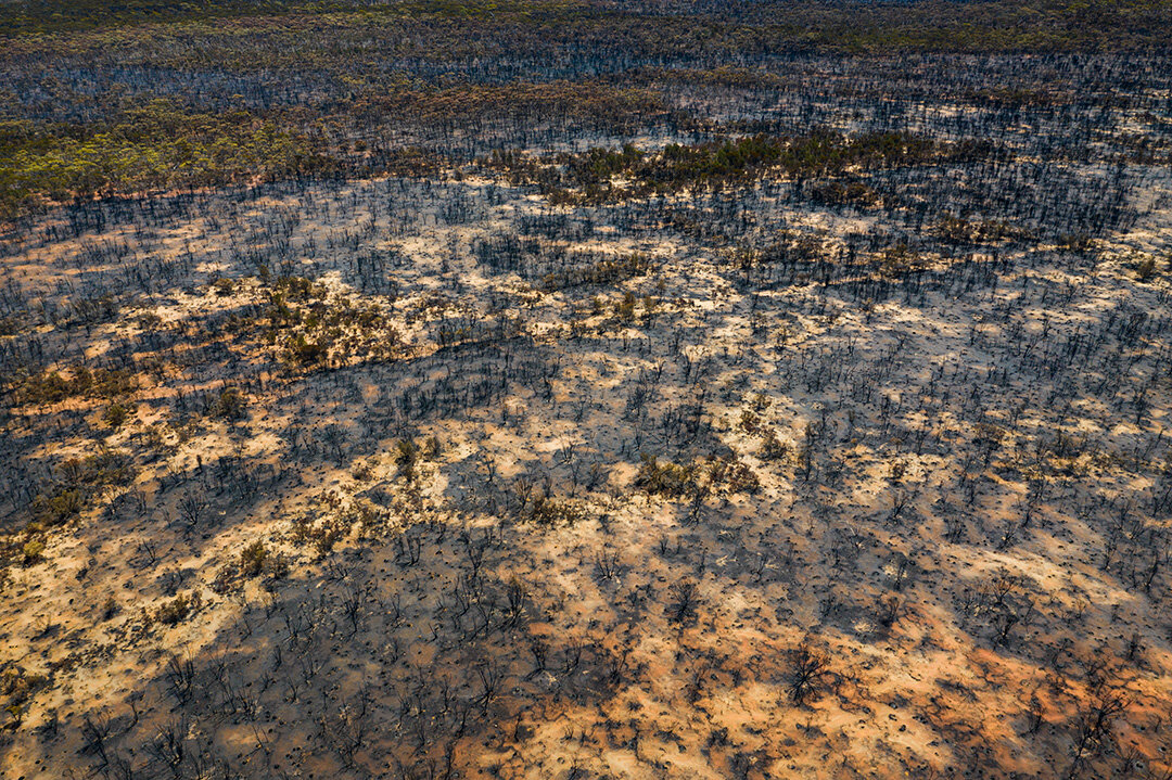
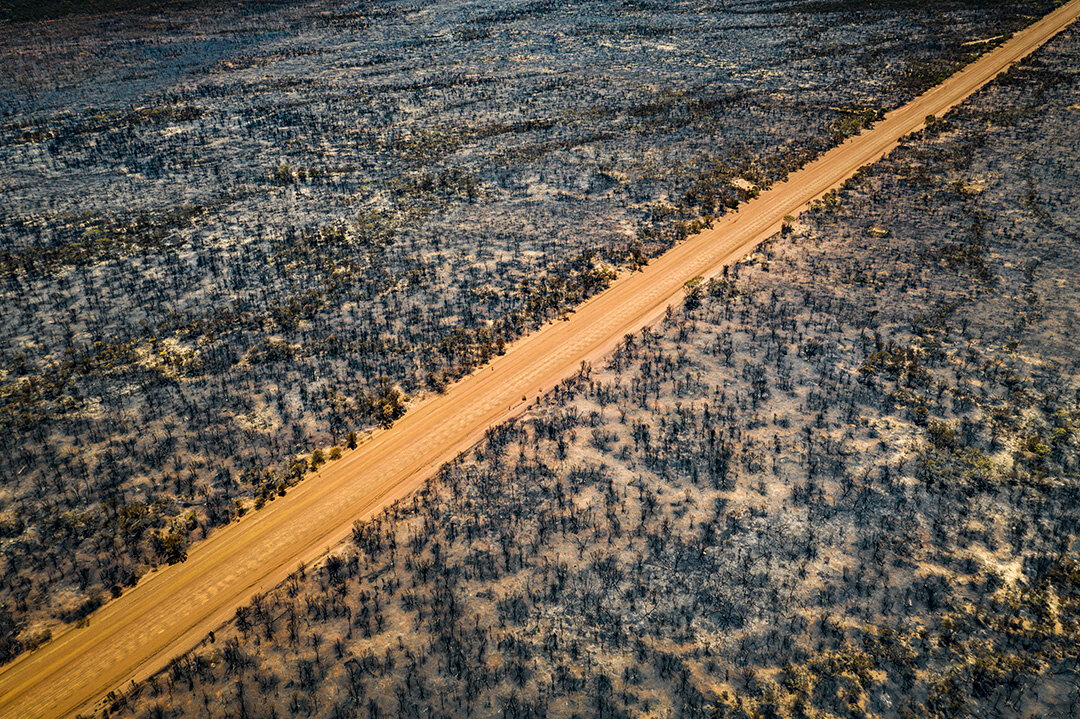
Today marked the last day of the road trip proceeding from the Fraser Range on the Nullabor through to Perth. I decided to take the 300km dirt Hyden-Norseman Rd from Norseman to Hyden and encountered the remnants of a nearby bushfire whilst travelling along this road. The fire fighters had actually closed the other end of this road by the time I got to the other side, which is not surprising given the size of the fire.

As mentioned at the start of this post, the drive totaled around 3,500kms which I completed over 6 days. It can definitely be done in less time, however taken some time to explore the areas that you’re passing through will make it much more enjoyable.

South Australia 2018

The following is a series of images taken during my two week travels throughout South Australia over the Summer break of 2017/2018.

Tom and

Tom and Eva Lookout, Port Campbell, Victoria

From Melbourne, I headed down to the Great Ocean Road and spent the night at Port Campbell. This shot was taken just after dawn, where I had gone down to the Razorback to take a number of images there at sunrise.

_NIK1803-HDR.jpg

Cape Dombey Obelisk, Robe, South Australia

Quite possibly one of the best sunsets that I saw in 2017. Believe it or not it was actually pouring down iwht rain a couple of hours before this. As such, I turned up more out of hope that naything. However when the sun started to set, the colours started to grow in intensity and they just continued to get stronger arnd stronger unitl it looked like the whole sky was on fire. This was easily on eo fthose scenarios where it’s always best to go out because you never know what you’re going to get.

_NIK1931.jpg

Ingalalla Falls, Hay Flat South Australia

Located halfway between the beautiful seaside town of Victor Harbour, and the departure point for Kangaroo Island (Cape Jervis), lies Ingallalla Falls.. A short walk from the base of the surrounding valley, these falls were particularly interesting due to the swirling mass of bubbles at the base. Making this a long exposure really allows you to see the movement at the base of the falls.

_NIK2366.jpg
_NIK2374.jpg
_NIK2638.jpg
_NIK2707.jpg

Remarkable Rocks/Admirals Arch, Kangaroo Island, South Australia

These series of photographs were taken from the south-west coast of Kangaroo Island within the Flinders Chase National Park. A rugged and windswept part of the island, this is home to the interesting rock formations known as the ‘Remarkable Rocks’ that appear to have been thrown out at the end of the peninsula by a giant. Furthermore, this section of coastline is a well known breeding ground for Australian and New Zealand Fur Seals, and I was lucky enough to see a number of mothers and their pups amongst the hundreds of seals that I saw there.

_NIK3229.jpg
_NIK3452.jpg
_NIK3930.jpg
_NIK4140.jpg
_NIK4367.jpg

A weekend in Tasmania

During the first three weeks of March, 2017 I was lucky enough to head down to Tasmania. Whilst I was primarily there on behalf of my workplace, I had the weekends to myself and dedicated one of the those weekends to solely exploring certain parts of Tasmania and photograph my travels in the process. I was lucky enough that the weekend that I chose was a long weekend (due to Monday being Labour Day) and as such spent 3 days exploring as set out below:

Friday - After finishing work in Launceston at 5pm I packed my photography equipment in the car and made the relatively short drive (~1.5h) down to Cradle Mountain. I got there just at the start of golden hour, and despite the sunset being a bit of a fizzer I hung around and took photos throughout twilight and into the night. I hadn't really gone out and tried the low light capabilities my camera bundle before this time (which consists of a Nikon D800 and a Nikkor 24-70mm f2.8 lens) and was in awe at how well it performed in low light.

Saturday - As with the sunset the evening prior, the sunrise really wasn't anything amazing on the Saturday morning, and add to the fact that as soon as I got to the boathouse to set up my camera a group of 6 other photographers all showed up clamoring to get the best position made it very difficult to get any good shots. Following this however I completed the trek to the summit of Cradle Mountain. It was an epic 6.5 hour trek via Lake Lilla and Marion's Lookout, with the last hour involving literally rock climbing in sections in order to reach the summit. Whilst being one of the hardest hikes that I have ever completed, the 360 degree views at the top of the summit are unparalleled and showcase amazing natural scenery as far as the eye can see. Coming down was much easier in comparison, and despite being exhausted by the time I reached the carpark, it was well worth it and something that I would definitely again and would recommend to others (provided that they are fit and are not afraid of heights).


Sunday - During the night, clouds had rolled in across Tasmania, leading to a fairly drab and overcast day. These conditions are perfect for photographing waterfalls, and after doing some quick searches I found that there were a couple of great waterfalls in Meander Valley, about an hour from Launceston. After getting lost amongst the maze of potholed dirt roads in Meander I eventually found my way to the carpark and set off hunting down these waterfalls. The first one, Chasm Falls, took just over an hour to reach through fairly dense rainforest. Due to the rain the night before the waterfall was flowing well, but the damp conditions had also brought out other creatures, and upon reaching the falls I realised I had three leeches sucking away at my left leg, one of them through the sock that I was wearing! Chasm Falls itself was absolutely beautiful and I spent around an hour exploring the immediate area and photographing it from various angles. From there I hiked up to Smoko Falls, which was around 2 hours through dense rainforest along a slippery and often poorly marked out track. Smoko Falls itself was a bit of let down, however there were numerous other waterfalls that I stopped over both going to and coming back from Smoko Falls which made the hike worth it.

Monday - Once again woke up at dawn to capture, the sunrise, this time over the Tamar River in downtown Launceston. Unlike the day before, this sunrise was really nice and whilst the sky was cloud-free, the golden hues reflected by the moving water was really beautiful to see. I made the 2 hour drive from Launceston to Freycinet National Park where I completed the hike to the summit of Mt Amos. This is a harder version of the walk to the lookout over Wineglass Bay, however gives even more stunning views of the surrounding coastline, including Wineglass Bay. Unfortunately for me, the day was fairly overcast, and whilst the views were still stunning, the intense contrast between the deep blue of the ocean and the white sands during a clear day would've made for a better photo.  Whilst not on the same day I also ended up heading down to Liffey Falls after work one day and was lucky to capture a few shots of it before the sun set and darkness set it.

All in all it was a very productive weekend and I was able to see and explore new places and get some pretty good photos in the process, which I was really happy with. Tasmania is really a stunning place in terms of natural scenery and I will definitely return here in the future (hopefully sooner rather than later).

Roadtrip 2016/17

In order to start the new year with a bang, I spent the first 10 days on a roadtrip, travelling from Melbourne to the Blue Mountains in NSW.

Traveling for me is primarily about exploring and discovering new places, and as such I generally rough it, sleep in my car or in the tent for a few hours each night before getting up in the early hours of the morning to capture the sunrise. I had done a similar trip as a child with my family, but wanted to try it again as an adult to see the comparison. I really enjoyed doing this trip and would love to do it again sometime in the future.

Highlights included:

Thurra River Sand Dunes - These huge sand dunes are some of the largest in Victoria and are less than an hour's walk for the Thurra River campground.

Mallacoota - Absolutely beautiful part of Victoria with pristine bright blue water and an amazing coastline with amazing short walks to places like Secret Beach and Shipwreck Creek. The nearby Genoa Peak is an absolute must-do for stunning 360 degree views of the surrounding land.

Wentworth Falls - Nestled within the Blue Mountains National Park lies Wentworth Falls. A plethora of walks ranging in difficult from easy half an hour walks to the arduous 5 hour trek through the Valley of the Waters, this area reflects the beautiful nature scenery that the Blue Mountains is known for. The National Pass trail is listed as one of the best walks in the entire park, and I was lucky enough to see a a group of people canyoning whilst I was doing it.

Kanangra Walls - About an hour's drive outside of the much more popular Jenolan Caves lie the Kanangra Walls. This huge natural stone structure runs for kilometres and with waterfalls, deep valleys and mountainous terrain it is an amazing sight to see. I flew my drone off here (in a video that I will upload soon) and the views were nothing short of spectacular.


Day 1: Traralgon, Tarra Bulga National Park, Loch Sport

Day 2: Sale, Lakes Entrance, Lake Tyers State Park, Croajingolong National Park

Day 3: Point Hicks Lighthouse, Thurra River, Mallacoota, Genoa Peak

Day 4: Secret Beach, Mallacoota, Mogo, Ulladulla, Kiama

Day 5: Kiama, Old Helensburgh Tunnel, Wentworth Falls, Katoomba

Day 6: Katoomba, Jenolan Caves, Kanangra Walls

Day 7: Wentworth Falls, Canberra

Day 8: Canberra, Carrum Beach